By Lucie Blahova
Marketing Lead, MEmob
Published: July 13th 2026
LinkedIn: Lucie Blahova
Geospatial intelligence and location intelligence are often used interchangeably; but they answer two different questions. Geospatial intelligence (GEOINT) analyzes imagery and geographic data to describe what is happening in the physical world. Location intelligence analyzes movement and visitation data to tell businesses what to do about it; who their customers are, where they go, and how to reach them.
If you’re evaluating a location intelligence platform, comparing data providers in the Middle East, or simply trying to untangle the terminology, this guide breaks down both disciplines, how they relate to GIS, and where each one delivers value for commercial teams in the GCC and beyond.
What is geospatial intelligence (GEOINT)?
Geospatial intelligence, or GEOINT, is the collection and analysis of imagery and geospatial data; satellite imagery, aerial photography, remote sensing, and mapping data to describe and assess physical features and human activity on Earth. The term originated in defense and national security, where analysts fuse satellite data with geographic information to monitor infrastructure, borders, and environmental change.
Today, geospatial intelligence extends well beyond the military. Governments use it for urban planning and smart city development, energy companies use it to monitor pipelines and assets, and environmental agencies use it to track climate impact. In the Gulf, geospatial intelligence underpins national mapping programs and giga-project planning, where satellite imagery and AI-driven analysis inform decisions about land use, transport corridors, and sustainable development.
The defining characteristic of geospatial intelligence is its top-down view: it looks at the Earth’s surface terrain, buildings, vegetation, infrastructure and derives insight from what can be observed and measured spatially.
What is location intelligence?
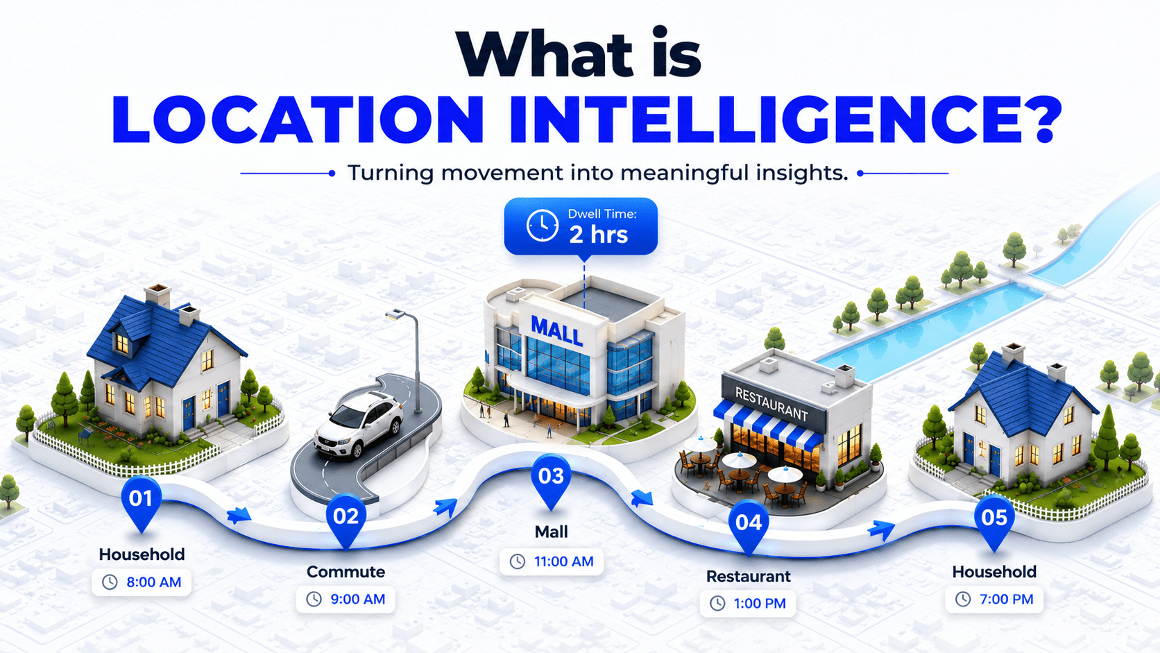
Location intelligence is the practice of analyzing location data; anonymized mobility signals, foot traffic, and points of interest (POI) to understand real-world consumer behavior and turn it into business decisions.
Instead of describing the physical world from above, location intelligence describes how people move through it: which stores they visit, how long they stay, where they came from, and where they go next.
For commercial teams, location intelligence answers questions like:
- Which audiences visit my stores and my competitors’ stores?
- Where should I open my next location?
- Did my advertising campaign actually drive footfall?
- How do visitation patterns shift during Ramadan, back-to-school season, or a major event?
Location intelligence platforms process billions of daily mobility signals against verified POI databases and enrich them with demographic and behavioral attributes. The output isn’t a map for its own sake; it’s audience segments you can activate in media campaigns, site-selection scores you can act on, and footfall attribution that proves whether marketing spend moved people through a door.
What is the difference between geospatial intelligence and location intelligence?
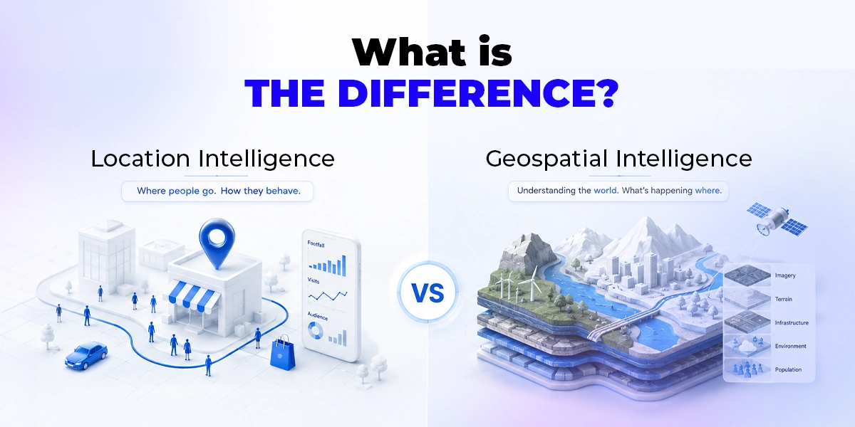
The core difference is direction and purpose: geospatial intelligence looks down at the world to describe places, while location intelligence looks at how people move between places to drive commercial decisions.
GEOINT’s raw material is imagery and geographic data; location intelligence’s raw material is anonymized mobility and visitation data. One tells you what the world looks like the other tells you what your customers do in it.
A useful shorthand: geospatial intelligence tells you about the world; location intelligence tells you what to do about it.
| Geospatial Intelligence (GEOINT) | Location Intelligence | |
| Primary question | What is happening in this place? | What are people doing, and how do we act on it? |
| Core data sources | Satellite imagery, aerial photography, remote sensing, mapping data | Anonymized mobility signals, foot traffic, POI data, audience attributes |
| Typical users | Governments, defense, urban planners, energy, environmental agencies | Marketers, retailers, real estate teams, tourism boards, agencies |
| Output | Maps, terrain analysis, change detection, situational assessments | Audience segments, footfall attribution, site selection, campaign measurement |
| Time orientation | Often periodic (imagery capture cycles) | Continuous, near-real-time behavioral signals |
| Commercial application | Infrastructure, land use, asset monitoring | Advertising activation, measurement, expansion strategy |
The two disciplines overlap both are forms of spatial analysis, and both may draw on the same POI and mapping foundations. But when a retail brand asks “which platform do I need?”, the answer is almost always location intelligence: the discipline built for audiences, activation, and attribution rather than imagery and terrain.
Is location intelligence the same as GIS?
No. A geographic information system (GIS) is the underlying technology for storing, visualizing, and analyzing spatial data the toolset. Location intelligence is a business practice that may use GIS techniques but focuses on consumer behavior and commercial outcomes.
GIS asks “how do we map and analyze this data?”; location intelligence asks “what should the business do next?”
Think of it in three layers:
- GIS: the foundational technology: spatial databases, mapping software, and analysis tools used across every spatial discipline.
- Geospatial intelligence: an analytical discipline built on GIS and imagery, focused on describing and assessing places, dominant in government and infrastructure.
- Location intelligence: a commercial discipline built on mobility and POI data, focused on audiences and decisions, dominant in marketing, retail, and real estate.
A GIS analyst produces maps and spatial models. A location intelligence platform produces audience segments, footfall benchmarks, and attribution reports that a CMO can act on the same week.
Is geospatial intelligence only for defense and government?
No; but the term’s center of gravity remains governmental. Geospatial intelligence grew out of defense and national mapping, and in the Middle East it is still most visible in satellite programs, smart city planning, and national infrastructure. Businesses searching for “geospatial intelligence” often discover that what they actually need is location intelligence: consumer-grade insight they can activate commercially.
This distinction matters when you’re shortlisting vendors. Satellite and GIS providers excel at imagery, mapping, and infrastructure analytics. But if your goal is understanding shoppers, targeting audiences, or measuring whether a campaign drove store visits, you need a location intelligence company whose data foundation is mobility signals and points of interest not pixels from orbit.
How do businesses use location intelligence?
Businesses use location intelligence across four stages: discovering audiences from real-world behavior, activating them in media campaigns,personalizing creative by location and context, and measuring offline impact through footfall attribution. Managed within one platform, these stages form a closed loop where every campaign generates data that sharpens the next one.
Common use cases by industry:
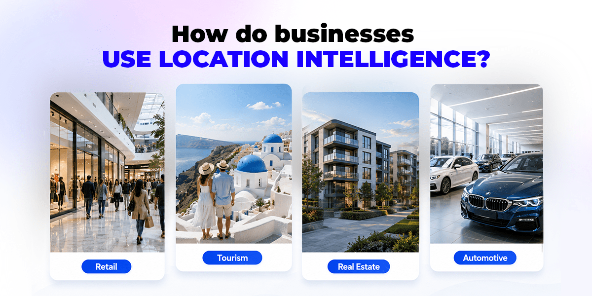
- Retail & malls: trade area analysis, competitor conquesting, measuring which campaigns drive incremental store visits.
- Tourism & DMOs: understanding visitor origins, dwell time, and movement corridors; distributing footfall across attractions.
- Real estate: site selection backed by visitation data; demonstrating catchment strength to investors and tenants.
- F&B and QSR: daypart visitation patterns, delivery zone optimization, drive-to-store campaigns.
- Automotive: showroom visit attribution, cross-shopping analysis between dealerships.
- Government & smart cities: anonymized mobility insight for event planning, transport, and urban management.
How is location intelligence data collected?
Location intelligence data comes from anonymized, consent-based mobility signals generated by mobile devices, matched against verified points of interest and enriched with aggregated demographic and behavioral attributes. Reputable providers process these signals under privacy frameworks such as the GDPR, the UAE Personal Data Protection Law (PDPL), and Saudi Arabia’s PDPL, working with device-level identifiers that are anonymized and aggregate; never names or personal profiles.
Quality varies enormously between providers, which is why data methodology should be a primary evaluation criterion.
Key questions to ask any location intelligence company: “How many daily signals do you process? How many POIs do you verify, and how often? Which consent and compliance frameworks govern your data supply? Can you demonstrate signal density in my markets, not just the US or Europe?”
Regional density is the factor most global platforms quietly fail on in the Middle East. A platform with deep US coverage may have thin, unrepresentative signal in Riyadh or Doha. For GCC campaigns, ask for market-specific signal and POI counts before you buy.
Why location intelligence matters in the GCC
The Middle East is one of the fastest-growing markets for spatial analytics in the world, and the GCC sits at its center. Three forces are driving adoption:
Vision-scale national programs. Saudi Vision 2030 and the UAE’s smart city agendas have made data and location intelligence core national infrastructure, from NEOM and Diriyah to Dubai 2040. Giga-projects need visitation insight as much as they need maps.
Mobile-first consumers. The UAE and Saudi Arabia have among the highest smartphone penetration rates globally, producing exceptionally rich mobility signal and exceptionally high expectations for personalized, well-timed marketing.
Offline-online convergence. Retail in the GCC remains anchored in physical destinations malls, souks, showrooms while media spend is overwhelmingly digital. Location intelligence is the bridge: it lets brands target digital audiences based on real-world behavior and then prove, through footfall attribution, that digital spend produced physical visits.
Global location intelligence platforms largely optimized for North American and European data supply. Regional accuracy, Ramadan seasonality, prayer-time visitation rhythms, expat audience composition, Arabic-language POI verification requires a data foundation built in and for the region.
Geospatial intelligence, location intelligence, or both?
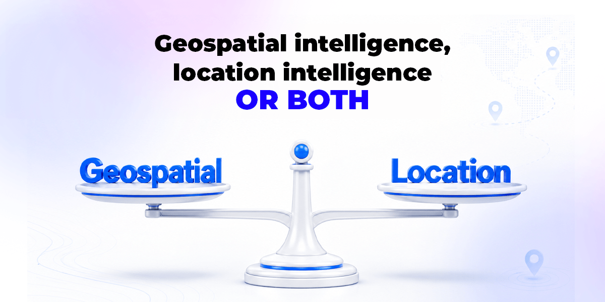
If your work involves terrain, imagery, infrastructure, or national planning, geospatial intelligence and GIS platforms are the right category. If your work involves customers finding them, reaching them, moving them, and measuring them you need location intelligence.
And within location intelligence, the platforms worth shortlisting are those that close the loop rather than stopping at dashboards. Insight that can’t be activated is just a prettier map. At MEmob+, that closed loop runs through four connected products: AllPings turns billions of daily mobility signals into audience and location insight, Excelate DSP activates those audiences programmatically across every channel, Blueprint adapts creative dynamically to location and context, and Stretch measures the footfall and offline impact of every campaign feeding what it learns back into the next audience build.
That’s the practical difference between studying the world and acting in it.
Frequently Asked Questions:
What does GEOINT stand for?
GEOINT stands for geospatial intelligence: the analysis of imagery and geospatial data to describe physical features and human activity on Earth. The term originated in the US defense community and is now used across government, infrastructure, and environmental applications worldwide.
Is geospatial data the same as location data?
Not quite. Geospatial data is the broad category covering any data with a geographic component, including satellite imagery and mapping data. Location data usually refers specifically to mobility signals showing where devices and therefore anonymized audiences move over time.
What is a location intelligence platform?
A location intelligence platform is software that processes anonymized mobility signals and POI data to deliver audience insights, footfall analytics, site-selection intelligence, and campaign attribution. Leading platforms also connect insight to activation, letting marketers target and measure audiences within the same ecosystem.
Which industries use location intelligence the most?
Retail, malls, F&B, tourism and destination marketing, real estate, automotive, and government are the heaviest adopters. Any organization with physical locations or customers who visit physical locations can use location intelligence for planning, marketing, and measurement.
What is footfall attribution?
Footfall attribution measures whether people who saw an advertising campaign subsequently visited a physical location, isolating the incremental visits the campaign produced. It’s the offline equivalent of digital conversion tracking and the primary way brands prove ROI on drive-to-store media.
Is location intelligence privacy-compliant?
Reputable location intelligence relies on anonymized, aggregated, consent-based signals governed by frameworks like the GDPR and the UAE and Saudi PDPLs. No personal identities are involved; analysis happens at the level of audience patterns, not individuals. Always verify a provider’s compliance framework before buying.